Server-side web GIS applications with Leaflet and PostGIS

  • Overview
  • Curriculum
  • Instructor
  • Review

About This Course

Accessing common data stores

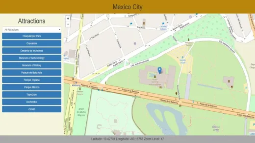
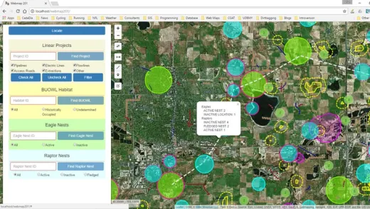
Server-side web GIS applications allow you to access GIS data stored in a multi-user database. This means that your data will always be current and any changes that other users make to the data will be immediately available in your application. You will be able to build complex GIS applications where some users will only be able to view certain data that you allow them and other users will be able to add, edit, and delete data from a web-interface. This means that your users will be able to interact with your GIS database from any device that has a compatible browser and an internet connection. They may be working in the field from a mobile device or from home on a mac OS computer, or on the other side of the world on a Linux computer.

This course uses PHP for the server-side language because of its popularity and its wide availability on web servers. We will use PostGIS as a spatial database, again because of its popularity and common usage in GIS applications. I teach standard web development methods that have stood the test of time and will still be available in many years after the latest, greatest, technology has been replaced with something even better. My goal as an instructor is to provide an introduction to the basic concepts. I don't think you will find any limitations with the software that I teach but if you ultimately decide to use a different server-side language, database, or a newer framework the methods you learn here will provide a solid foundation.

Best of all, this course uses all open source software so there are no costs involved. I have had projects involving more than 50 people, including clients, accessing the same database through web interfaces and desktop GIS for several years with no problem and with no cost other than web-hosting which cost us about $10/month total.

  • Develop complex web GIS applications using data stored in a PostGIS database with open source software that doesn't require any licensing fees or subscriptions.

Course Curriculum

Instructor

Profile photo of Michael Miller
Michael Miller

I have been programming and working with database applications for over 30 years, and specializing in geospatial applications for over 20 years.  I am a believer in the 80/20 pareto principle which suggests that you only need to understand 20% of a subject in order to do 80% of your work. My goal in all my courses is to teach...

Review
4.9 course rating
4K ratings
ui-avatar of Gul Afzal
Gul A.
4.5
10 months ago

good

  • Helpful
  • Not helpful
ui-avatar of Alexandru Nazîru
Alexandru N.
5.0
1 year ago

It teaches me code that I would of struggled to find on my own. Never learned GIS so complex in school. Thx for this course. I am learning a lot.

  • Helpful
  • Not helpful
ui-avatar of Fathulloh
Fathulloh
5.0
1 year ago

good..

  • Helpful
  • Not helpful
ui-avatar of David Alday
David A.
5.0
1 year ago

Recomendable.

  • Helpful
  • Not helpful
ui-avatar of Roman Villarreal
Roman V.
4.0
1 year ago

hasta ahora esta bien, faltan conseptos generales de json y otros datos para mantener ,as claro el tema

  • Helpful
  • Not helpful
ui-avatar of Nu Kyang
Nu K.
4.0
1 year ago

So far so good

  • Helpful
  • Not helpful
ui-avatar of Mohamed Alannabi
Mohamed A.
5.0
1 year ago

as always, great content, great teacher.

  • Helpful
  • Not helpful
ui-avatar of Claude Mushid
Claude M.
5.0
1 year ago

The course still excellent ! I'm still following if something not really good I'll reduce my score.

  • Helpful
  • Not helpful
ui-avatar of Ushant Suman
Ushant S.
4.5
2 years ago

good

  • Helpful
  • Not helpful
ui-avatar of Clareen Rynjah
Clareen R.
4.0
2 years ago

Yes it is, as I would like to know implementing those filters

  • Helpful
  • Not helpful
Leave A Reply

Your email address will not be published. Required fields are marked *

Ratings

Courses You May Like

Lorem ipsum dolor sit amet elit
Show More Courses