Introduction to Spatial Databases with PostGIS and QGIS 3

  • Overview
  • Curriculum
  • Instructor
  • Review

About This Course

Learn Spatial SQL and database management for GIS Professionals

This course is intended to provide an introduction to spatial databases in general and PostGIS in particular to GIS professionals who are interested in expanding their skillset to multi-user enterprise level spatial databases. This course uses the latest (as of 2/18) versions of PostgreSQL (10.1), PostGIS (2.4), and QGIS (3.0). I believe it is the most current and thorough course on spatial databases available today. You will learn

  • What a spatial database is and why you would want to use one.

  • What SQL is, why you would want to use it, and how it can be applied to geospatial concepts.

  • How to install PostGIS locally for development purposes and how to access a production version via a network or the internet.

  • How to load your spatial data into PostGIS and access it from a variety of clients, especially QGIS

  • The basics of SQL for both spatial and non-spatial queries

  • How to validate data and control user access with the tools built-in to PostGIS

  • Optimizing your queries for the best performance

  • How to work with raster data in PostGIS

  • The basics of programming custom functions with PL/pgSQL

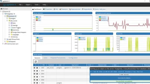
  • The basics of database administration to keep your database operating smoothly

  • Understand the advantages of storing spatial information in spatially enabled databases

  • Install PostGIS locally for development purposes and/or access an instance of PostGIS that is running on their organizations intranet, a web host, or the cloud

  • Write SQL queries to retrieve and analyze spatial data.

Course Curriculum

Instructor

Profile photo of Michael Miller
Michael Miller

I have been programming and working with database applications for over 30 years, and specializing in geospatial applications for over 20 years.  I am a believer in the 80/20 pareto principle which suggests that you only need to understand 20% of a subject in order to do 80% of your work. My goal in all my courses is to teach...

Review
4.9 course rating
4K ratings
ui-avatar of Rose Mayienda
Rose M.
5.0
8 months ago

It is exactly what I have been looking for

  • Helpful
  • Not helpful
ui-avatar of Joshua De Leon
Joshua D. L.
3.5
10 months ago

The lecturer is very knowledgeable and well experience. To have a better learning experience, it can be enhance by having small bits of exercises and problem solving every end of major topics

  • Helpful
  • Not helpful
ui-avatar of Karen King
Karen K.
1.0
10 months ago

I was disappointed that the download instructions were inadequate. Once you get stuck, there was little to no help. Sad. I really wanted to learn spatial data analysis.

  • Helpful
  • Not helpful
ui-avatar of Nikos
Nikos
4.0
1 year ago

The course was very good however more interaction from student is required with small assessment tests and big challenges. In the whole course only 2 sections were used to challenge the student. Also there is no deep understanding of the examined database (purpose/overall schema etc).

  • Helpful
  • Not helpful
ui-avatar of YONAS Negusie Ayele
Yonas N. A.
4.0
1 year ago

Yes I am a project manager for company that works on huge data sets for electrification projects.

  • Helpful
  • Not helpful
ui-avatar of Davit Bakuradze
Davit B.
3.5
1 year ago

As there are limited options for PostGIS courses online, I found this course to be a valuable resource for expanding my knowledge of PostGIS. Here are my thoughts on the course:

Advantages:

1 Comprehensive coverage: The course covers a wide range of topics, providing a solid foundation in PostGIS.
2 Experienced instructor: The tutor shares valuable insights, hints, and personal experiences, making the course more engaging and informative.
3 Multiple problem-solving approaches: The course demonstrates different ways to solve a problem, which helps in developing a deeper understanding of the subject.
Disadvantages:

1 Pace and clarity: As a non-native English speaker, I found the instructor's speaking pace to be too fast, and the words were not always clear. It would be helpful to have better transcripts or slower speech.
2 Theory vs. practice: While the course covers a lot of theory, I would have liked to see more practical exercises. A 1-hour video showcasing a complete example from start to finish, resulting in a well-designed database, would be beneficial.
3 Additional topics: It would be great to cover topics like integrating PostGIS with GeoServer and Leaflet.js, which are essential for real-world applications.
4 Limited course materials: The course could benefit from providing more resources, such as PowerPoint slides, concise theory notes, essential function explanations, and terminology definitions.
I hope this feedback helps in improving the course and making it more accessible to a wider audience.

  • Helpful
  • Not helpful
ui-avatar of Charlotte Fries
Charlotte F.
4.0
1 year ago

A lot of good information which makes for a great introduction. Not all that engaging, but does the job and does it pretty well.

  • Helpful
  • Not helpful
ui-avatar of Oluwatobiloba Oyedero
Oluwatobiloba O.
5.0
1 year ago

Very helpful!

  • Helpful
  • Not helpful
ui-avatar of Emmanuel Ayisi
Emmanuel A.
5.0
1 year ago

Engaging content. Very consistent with the communication of what Spatial Databases are.

  • Helpful
  • Not helpful
ui-avatar of Jedidiah Chibinga
Jedidiah C.
5.0
1 year ago

Awesome course, great value for money.

  • Helpful
  • Not helpful
Leave A Reply

Your email address will not be published. Required fields are marked *

Ratings

Courses You May Like

Lorem ipsum dolor sit amet elit
Show More Courses