Learn geographic information systems (GIS) with QGIS

Dive into the world of GIS with our friendly course on QGIS! Learn to manage spatial info, solve real-world problems, and create stunning maps—all at your own pace.

  • Overview
  • Curriculum
  • Instructor
  • Review

Brief Summary

This course is your gateway to becoming a QGIS wizard. We’ll take it step-by-step, and before you know it, you’ll be creating maps and solving spatial puzzles like a pro!

Key Points

  • Learn to use QGIS for managing spatial data
  • Understand the difference between raster and vector data
  • Create maps and share your work online

Learning Outcomes

  • Be able to navigate the QGIS interface with ease
  • Perform data manipulation using QGIS tools
  • Present cartographic maps effectively

About This Course

learn how to use open source GIS software to manage spatial information

Are you interested in gaining skills in the growing field of geographic information science?  Are you already a GIS professional but want to learn how to use a powerful free and open source GIS product?  If so, this course is for you.

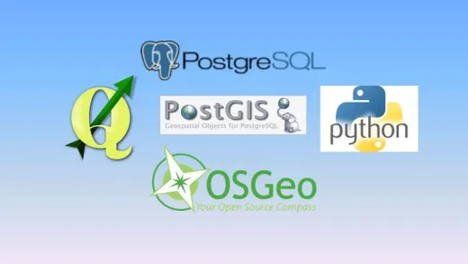
In this course, I'm going to teach you how to use Quantum GIS (better known as QGIS) to perform GIS tasks to solve spatial problems.  Working alongside me you will be introduced to the QGIS interface, and you will then engage in real-world projects to use QGIS for solving vector, raster, and database problems.  And for those of you looking to learn how to present cartographically aesthetic map products, I'm going to show you how to use the QGIS Composer applications.

Finally, after being introduced to the basics of QGIS, working on some real world problems, and making your final maps, I will show you how to put your spatial data on the Internet for the world to see.

I've been teaching GIS for over 20 years, and while I can't come to your house and teach you, these videos are the best way to have me work along side you.  So, find a comfortable place to hide away, and after a weekend with these materials, you'll be able to successfully use QGIS within a professional setting.

  • Understand the basic features that a GIS offers

  • Articulate the difference between raster and vector data sources

  • Utilize QGIS to perform raster, vector, and database manipulation

Instructor

Profile photo of Arthur Lembo
Arthur Lembo

Dr. Arthur J. Lembo, Jr. is an educator with a passion for GIS and almost 30 years of GIS industry experience.  He has won numerous teaching awards, including the prestigious New York State Chancellors award for Excellence in Teaching (2006), and the Maryland Board of Regents Teaching Award (2018) - both of these awards are the highest awards in academia...

Review
4.9 course rating
4K ratings
ui-avatar of Krystian
Krystian
3.5
3 years ago

It should be an update, for new version of qgis at least resources. It should be mention, that it is for qgis 2.18. It is not a big issue, but more info is good for customers

  • Helpful
  • Not helpful
ui-avatar of Vishnuraj
Vishnuraj
2.0
4 years ago

just goes too fast. does not explain different tabs and their purpose

  • Helpful
  • Not helpful
ui-avatar of Wendy Talio
Wendy T.
4.0
4 years ago

This was a nice complement to the 'official' tutorial on the QGIS.org site. While the version of the software is VERY different now, the information in the video was still illuminating. Eg. one accesses OSM data differently now (I'm in 3.10) but if I hadn't watched the video I wouldn't have known to look for it at all.

  • Helpful
  • Not helpful
ui-avatar of Shubham Sharma
Shubham S.
3.0
4 years ago

some things are not explanied in details
but still a good for basics

  • Helpful
  • Not helpful
ui-avatar of Anthony Walton
Anthony W.
4.0
5 years ago

Informative

  • Helpful
  • Not helpful
ui-avatar of Igor Carneiro
Igor C.
4.0
5 years ago

It was really good to refresh some functions of Qgis But I think it's necessary to provide the data of the beginning of the course as of the end when regarding Open street maps. But in general, It was really worthy attending these classes.

  • Helpful
  • Not helpful
ui-avatar of Antony Sansom
Antony S.
4.0
5 years ago

Enjoyable and certainly building on the knowledge gains from the other GIS course and goes into a little more detail about QGIS and its functionality

The first section where we get an overview of the various menus there is little explanation of the tools or what they are used for or could be used for, this section feels a little we are rushing through a little bit to quickly. Also the video appears to use an older version of QGIS which makes things a little tricky as the menus have changed considerably as well as when following on with the tasks in section 2 I get output errors whilst attempting to undertake the Buffer and census task.

I found the final section on Cartography takes you through how to create a map on using QGIS, even though the presenter is using an older version spending a bit of time with the QGIS programme you can work out how to complete the tasks.

  • Helpful
  • Not helpful
ui-avatar of Muhammad Omar Ali
Muhammad O. A.
4.0
5 years ago

it was cool ,nice and easy to understand

thank you

  • Helpful
  • Not helpful
ui-avatar of Troy Campbell
Troy C.
5.0
5 years ago

The lecturer wastes no time and there is value in the things that he points out. Explanation is clear and straightforward. Good for experienced users of software and natural scientists.

  • Helpful
  • Not helpful
ui-avatar of Dipesh Karmarkar
Dipesh K.
5.0
5 years ago

It was an excellent way of learning!

  • Helpful
  • Not helpful
Leave A Reply

Your email address will not be published. Required fields are marked *

Ratings

Courses You May Like

Lorem ipsum dolor sit amet elit
Show More Courses